Products
-
 Original price $0 - Original price $0Original price $0$34.900$34.900 - $34.900Current price $34.900
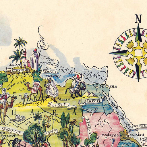
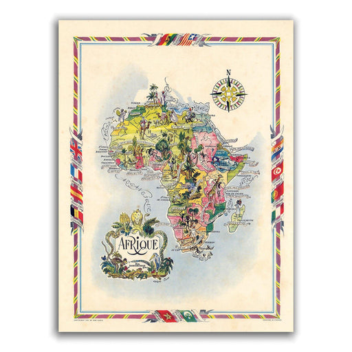
Illustrated Africa - Art Print
Some time ago we wanted to launch an Illustrated Map of Africa, until we came across this gem. 💎 Colorful and cheerful, with even comical illustrat...
View full detailsOriginal price $0 - Original price $0Original price $0$34.900$34.900 - $34.900Current price $34.900 -
 Original price $0 - Original price $0Original price $0$41.900$41.900 - $41.900Current price $41.900
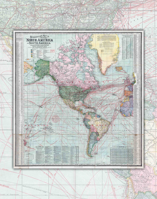
1910 America - Art Print
Size: 69x73cm Year : 1910 Scale : 1 : 26,000,000 Printing: Canson 180gsm Art Paper. Shipments : Within Santiago, other shipment...
View full detailsOriginal price $0 - Original price $0Original price $0$41.900$41.900 - $41.900Current price $41.900 -
 Original price $0 - Original price $0Original price $0$41.900$41.900 - $41.900Current price $41.900
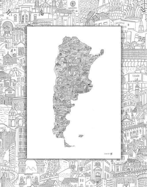
Argentina by Hand - Art Print
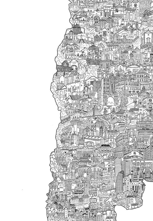
In this Map of Argentina, the illustrator Josefina Jolly seeks to show the architecture of the country, traveling province by province with the dra...
View full detailsOriginal price $0 - Original price $0Original price $0$41.900$41.900 - $41.900Current price $41.900 -
 Original price $0 - Original price $0Original price $0$18.990$18.990 - $18.990Current price $18.990
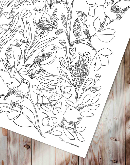
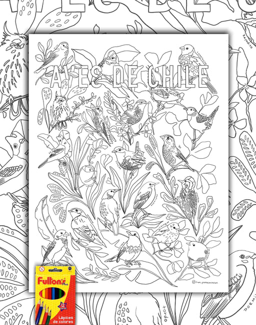
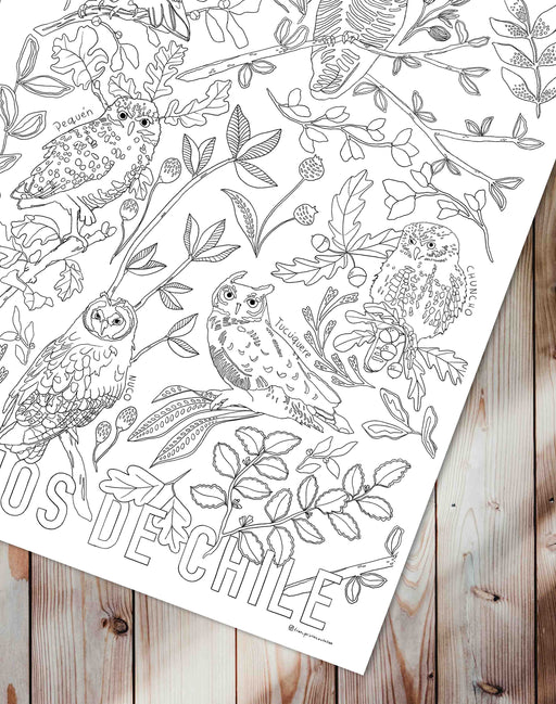
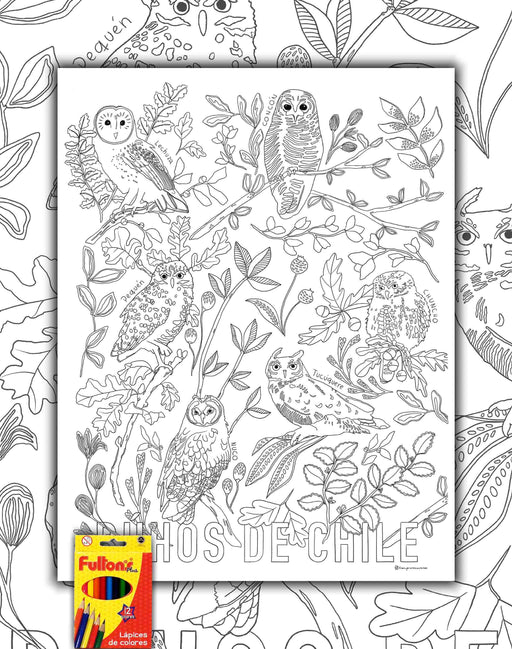
Birds of Chile - Colorable Sheet with Pencils
Size : 50x70cm Printing : Canson Art Paper of 180grs. Shipping : Worldwide rolled in a Mappin box. The illustrator Francisca Prie...
View full detailsOriginal price $0 - Original price $0Original price $0$18.990$18.990 - $18.990Current price $18.990 -
 Original price $44.900 - Original price $44.900Original price$44.900$44.900 - $44.900Current price $44.900
Birds of Chile Fantastic Plumiferous - Art Print
"Birds are revealed in the air, sea, forests, valleys, deserts and wetlands. Their characteristics are fantastic. In this work certain points of t...
View full detailsOriginal price $44.900 - Original price $44.900Original price$44.900$44.900 - $44.900Current price $44.900 -
 Original price $44.900 - Original price $44.900Original price$44.900$44.900 - $44.900Current price $44.900
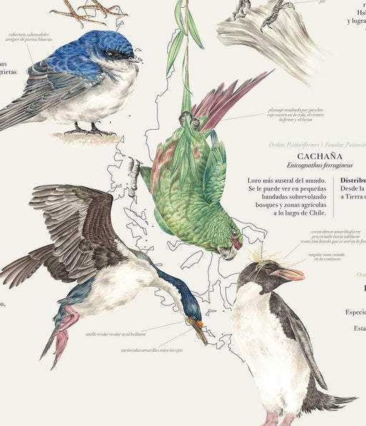
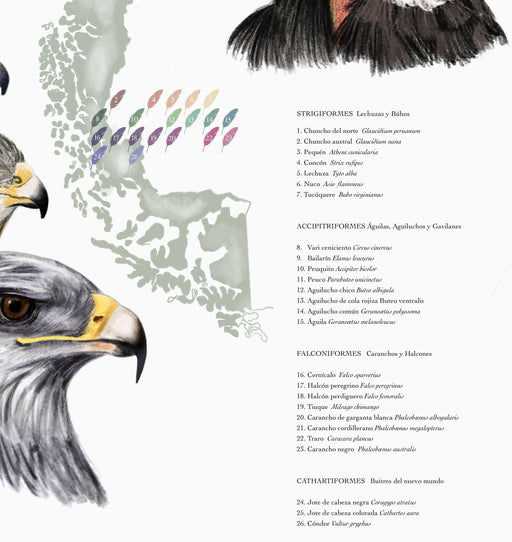
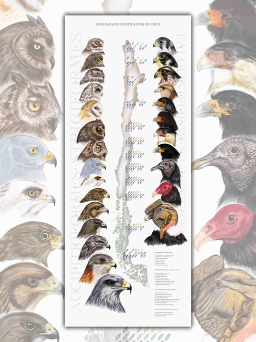
Chilean Birds of Prey Nesting - Print
This beautiful map is an infographic that illustrates the Raptors that inhabit the territory, their distribution and family classification. Humb...
View full detailsOriginal price $44.900 - Original price $44.900Original price$44.900$44.900 - $44.900Current price $44.900 -
 Original price $0 - Original price $0Original price $0$18.990$18.990 - $18.990Current price $18.990
Owls of Chile - Colorable Sheet with Pencils
Size : 50x70cm Printing : Canson Art Paper of 180grs. Shipping : Worldwide rolled in a Mappin box. The illustrator Francisca Prie...
View full detailsOriginal price $0 - Original price $0Original price $0$18.990$18.990 - $18.990Current price $18.990 -
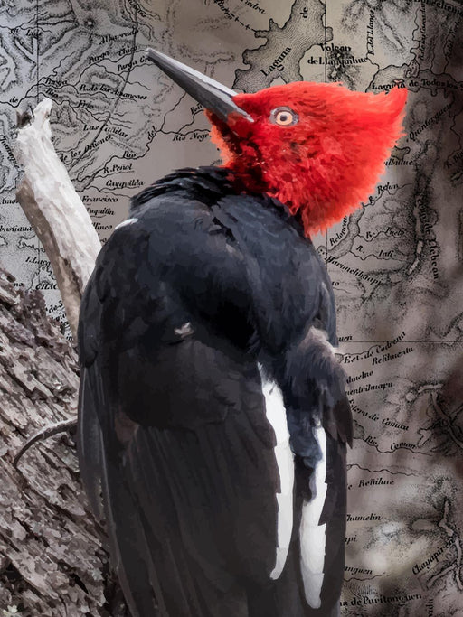
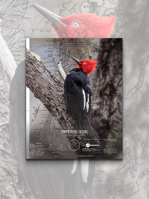 Original price $0 - Original price $0Original price $0$39.000$39.000 - $39.000Current price $39.000
Black Woodpecker Scale Art - Art Print
Arte Escala seeks to bring wildlife closer to your home. We create incredible sheets of animals in their real scale , with various information and ...
View full detailsOriginal price $0 - Original price $0Original price $0$39.000$39.000 - $39.000Current price $39.000 -
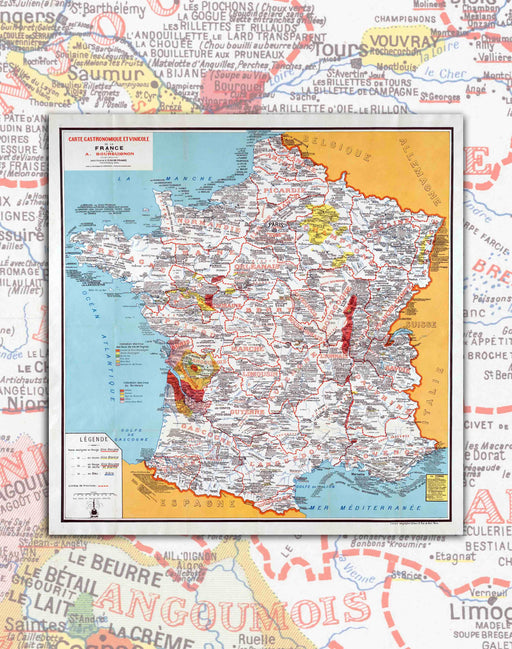 Original price $0 - Original price $0Original price $0$39.900$39.900 - $39.900Current price $39.900
Carta Gastronómica de Francia - Lámina
Tamaño: 69x68cm Impresión: Papel de Arte 230gsm. Libre de ácido. Envíos: A todo el Mundo enrollado en Caja Mappin. Año: 1932 Un gran mapa que...
View full detailsOriginal price $0 - Original price $0Original price $0$39.900$39.900 - $39.900Current price $39.900 -
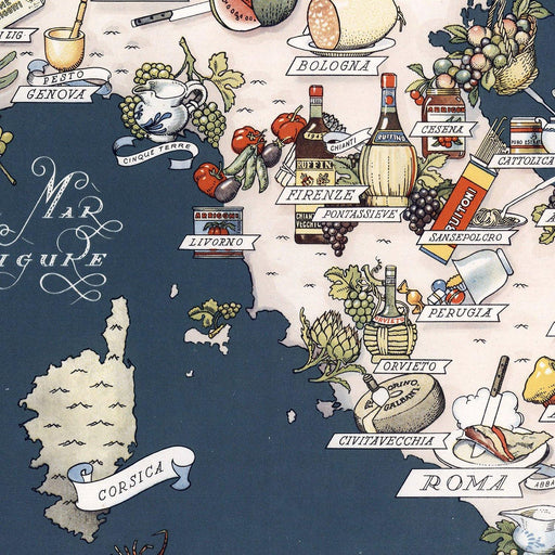
 Original price $35.900 - Original price $35.900Original price$35.900$35.900 - $35.900Current price $35.900
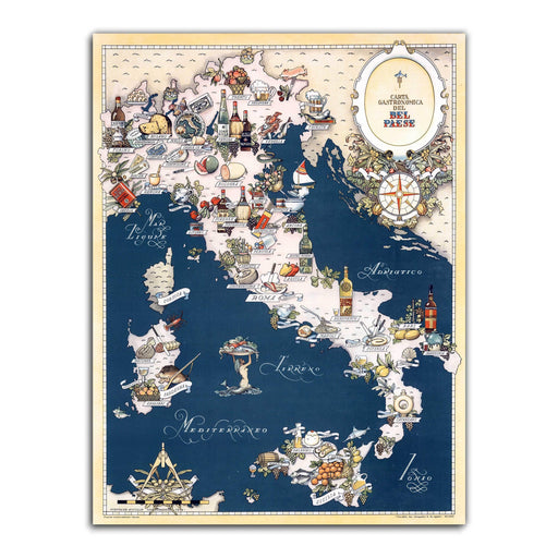
Gastronomic Menu of Italy - Print
Do you like gastronomy? Italian? You found your ideal Mappin! Even if you don't like Italy or gastronomy, this print is so incredible in colors,...
View full detailsOriginal price $35.900 - Original price $35.900Original price$35.900$35.900 - $35.900Current price $35.900 -
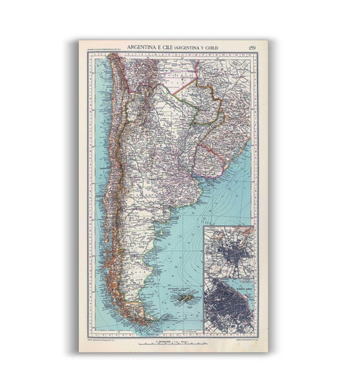
 Original price $0 - Original price $0Original price $0$32.900$32.900 - $32.900Current price $32.900
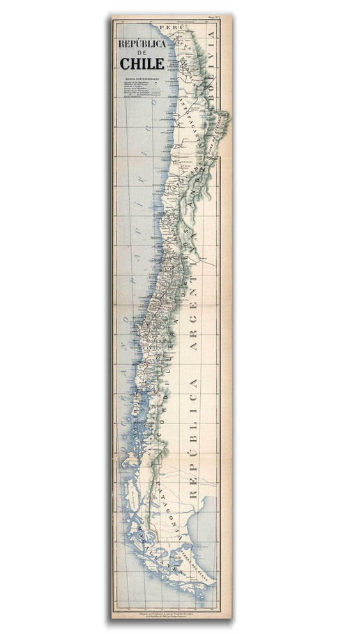
Chile in 1903 - Print
Long, but very long. This was Chile at the beginning of the 20th century. Well, now it still is, but a little less. This map of the country has ...
View full detailsOriginal price $0 - Original price $0Original price $0$32.900$32.900 - $32.900Current price $32.900 -

 Original price $0 - Original price $0Original price $0$44.900$44.900 - $44.900Current price $44.900
Flowery Chile - Art Print
Did you know that in Chile there are many flowers that only grow in our territory? The illustrator Rosemarie Cerdá Cattan (@ rosemarie.cc ) made a...
View full detailsOriginal price $0 - Original price $0Original price $0$44.900$44.900 - $44.900Current price $44.900 -
 Original price $44.900 - Original price $44.900Original price$44.900$44.900 - $44.900Current price $44.900
Regenerative Chile - Foil
This incredible and detailed Map is inspired by the work of the English designer William Morris. Its author, Joaquín Rosas, represents in detail t...
View full detailsOriginal price $44.900 - Original price $44.900Original price$44.900$44.900 - $44.900Current price $44.900 -
 Original price $0 - Original price $0Original price $0$44.900$44.900 - $44.900Current price $44.900
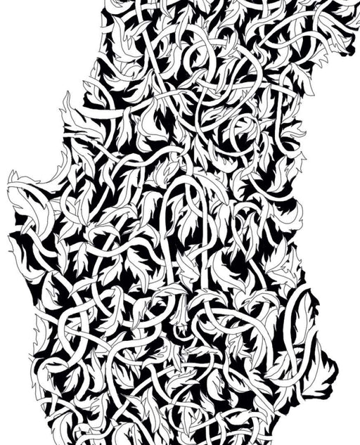
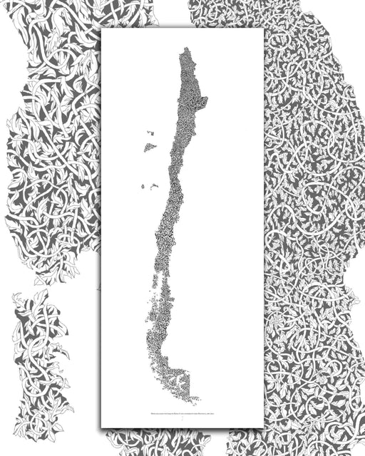
Chile Urdido - Sheet
The work of this Chilean visual artist is incredible! It is based on a set of colors and wefts that come together to shape this Chile that is born...
View full detailsOriginal price $0 - Original price $0Original price $0$44.900$44.900 - $44.900Current price $44.900 -
 Original price $39.900 - Original price $39.900Original price$39.900$39.900 - $39.900Current price $39.900
Chile and Argentina in 1929 - Print
How much detail! This large map of the southern cone of America details hundreds of cities and towns, mainly passing through Chile and Argen...
View full detailsOriginal price $39.900 - Original price $39.900Original price$39.900$39.900 - $39.900Current price $39.900 -
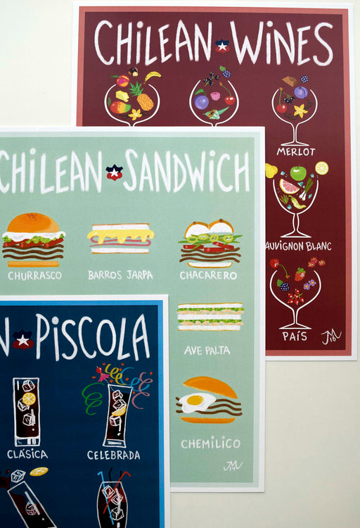
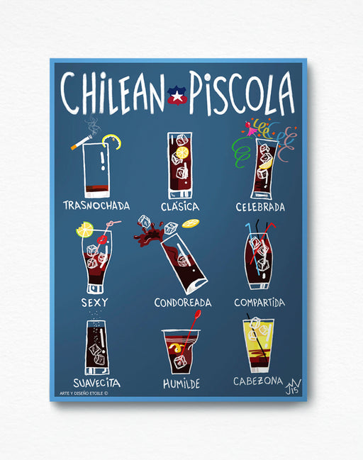
Original price $15.900Original price $15.900 - Original price $15.900Original price $15.900Current price $9.900$9.900 - $9.900Current price $9.900
Chilean Piscola - Lámina
Tamaño: 22x29cm Papel: Couché 300grs. Impresión Offset. Envíos: A todo el Mundo enrollado en caja Mappin. El afiche ilustrado de "Chilean Pisco...
View full detailsOriginal price $15.900Original price $15.900 - Original price $15.900Original price $15.900Current price $9.900$9.900 - $9.900Current price $9.900Save 38% -
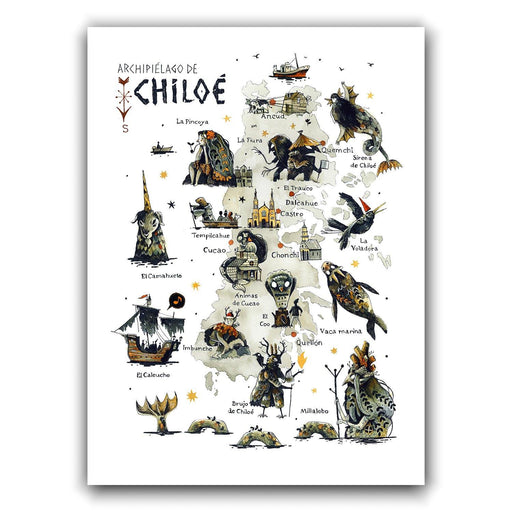
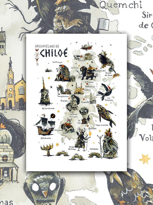 Original price $0 - Original price $0Original price $0$41.900$41.900 - $41.900Current price $41.900
Mythological Chiloé - Print
The Chilean illustrator Alfredo Cáceres had already made the Mythological Map of Chile some time ago. As it quickly ran out, we embarked on a new a...
View full detailsOriginal price $0 - Original price $0Original price $0$41.900$41.900 - $41.900Current price $41.900 -
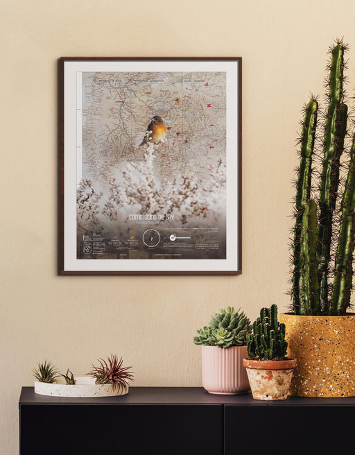
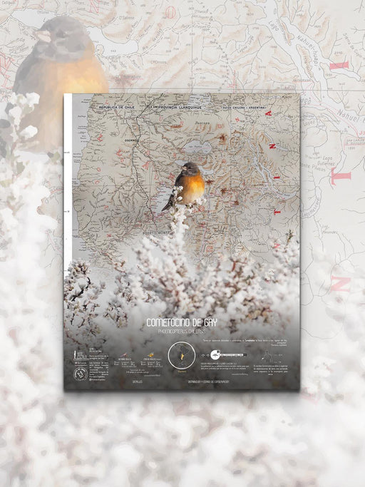 Original price $0 - Original price $0Original price $0$39.000$39.000 - $39.000Current price $39.000
Cometocine Scale Art - Art Print
Arte Escala seeks to bring wildlife closer to your home. We create incredible sheets of animals in their real scale , with various information and ...
View full detailsOriginal price $0 - Original price $0Original price $0$39.000$39.000 - $39.000Current price $39.000 -
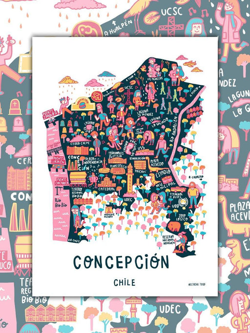 Original price $0 - Original price $0Original price $0$45.900$45.900 - $45.900Current price $45.900
Illustrated Conception - Print
The Illustrated Map of Concepción is a map as a reflection of the everyday or the most recognized; from the night reel down Argentina street to tou...
View full detailsOriginal price $0 - Original price $0Original price $0$45.900$45.900 - $45.900Current price $45.900 -
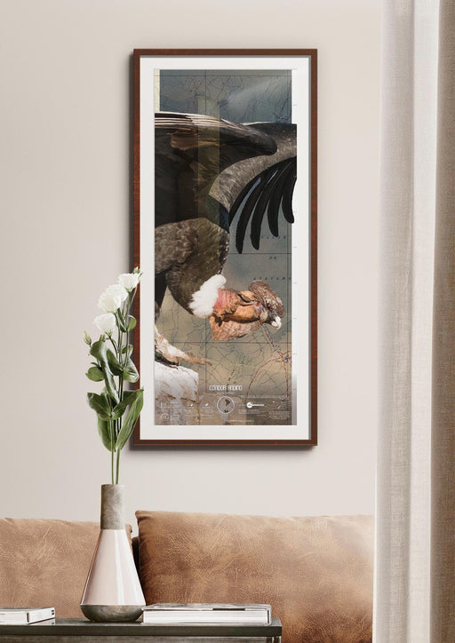
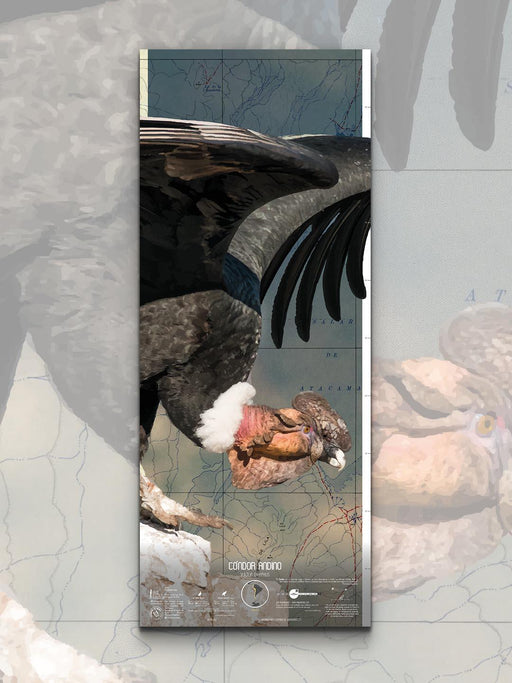 Original price $0 - Original price $0Original price $0$44.000$44.000 - $44.000Current price $44.000
Andean Condor Scale Art - Art Print
Arte Escala seeks to bring wildlife closer to your home. We create incredible sheets of animals in their real scale , with various information and...
View full detailsOriginal price $0 - Original price $0Original price $0$44.000$44.000 - $44.000Current price $44.000 -

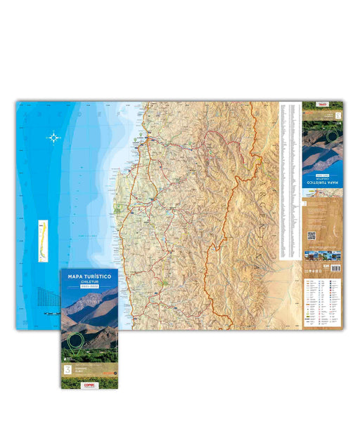 Original price $7.900 - Original price $7.900Original price$7.900$7.900 - $7.900Current price $7.900
Copiapó and Elqui - Chiletur Tourist Map
To travel has been said! 2 maps printed on both sides covering 530 kilometers from North to South, from Copiapó to Los Vilos. Highlights: Nevado...
View full detailsOriginal price $7.900 - Original price $7.900Original price$7.900$7.900 - $7.900Current price $7.900 -
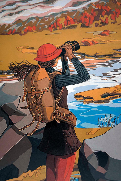
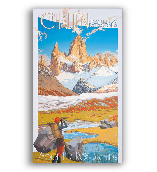
Original price $25.900Original price $25.900 - Original price $25.900Original price $25.900Current price $15.900$15.900 - $15.900Current price $15.900
El Chalten / Mount Fitz Roy - Art Print
A beautiful Patagonian poster made by the talented Argentine Julieta Fernández Cánepa . With a vintage style and a range of incredible colors, t...
View full detailsOriginal price $25.900Original price $25.900 - Original price $25.900Original price $25.900Current price $15.900$15.900 - $15.900Current price $15.900Save 39% -

 Original price $22.000 - Original price $22.000Original price$22.000$22.000 - $22.000Current price $22.000
El Encanto, Pirihueico 1928 - Lámina
Una hermosa colaboración junto a Fundación Enterreno, quienes rescatan, digitalizan y ponen a disposición miles de fotografías históricas al públic...
View full detailsOriginal price $22.000 - Original price $22.000Original price$22.000$22.000 - $22.000Current price $22.000 -
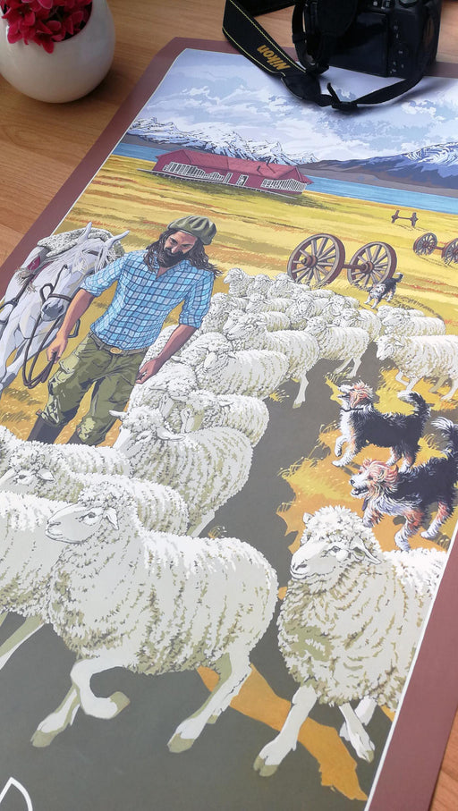
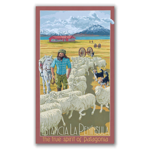
Original price $25.900Original price $25.900 - Original price $25.900Original price $25.900Current price $15.900$15.900 - $15.900Current price $15.900
La Península Ranch - Print
An incredible Patagonian poster made by the talented Argentine Julieta Fernández Cánepa. With a vintage style and a range of incredible colors, th...
View full detailsOriginal price $25.900Original price $25.900 - Original price $25.900Original price $25.900Current price $15.900$15.900 - $15.900Current price $15.900Save 39%