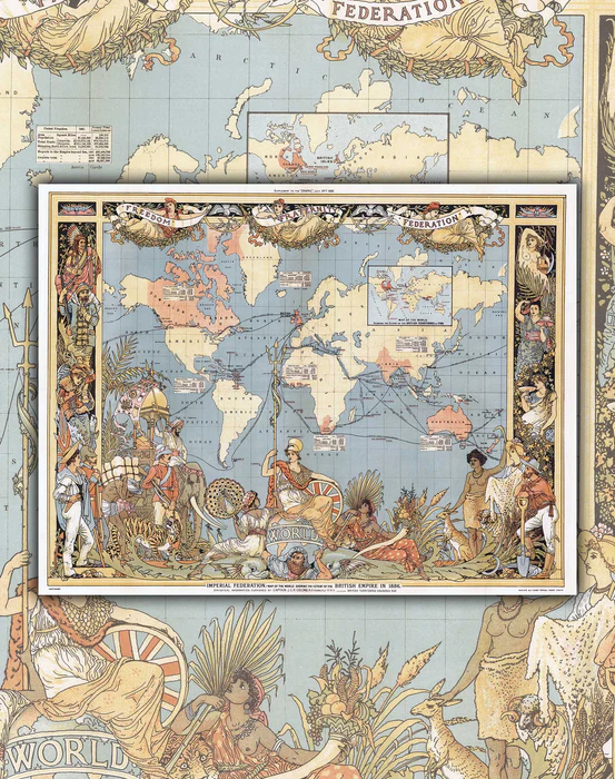


World Map of 1886 - Print
Original price
$32.000
-
Original price
$32.000
Original price
$32.000
$32.000
-
$32.000
Current price
$32.000

Envío inmediato
Fabricamos con cariño; pide este producto antes de las 11:00 am de hoy para tenerlo entre el Lunes 08 de Junio y Miércoles 10 de Junio.

Fabricamos con cariño
Pide este producto antes de las 11:00 am para tenerlo entre el Miércoles 10 de Junio y Lunes 15 de Junio.
One of the most beautiful World Maps we have, where the illustrations of the time take the sheet and accompany the trade routes drawn for the British Empire.
A real gem! You can see the trade routes they had, along with their colonies, which are demarcated with a light orange color. It is undoubtedly a "photo" of a very significant historical process of the 19th century.
- Size : 56x43cm
- Printing : Canson paper of 180grs. specialized in art reproduction.
- Year : 1886
- Shipping: Worldwide rolled in Mappin Box.