Mapas de Chile: Actualizados
-
 Original price $0 - Original price $0Original price $0$21.900$21.900 - $21.900Current price $21.900
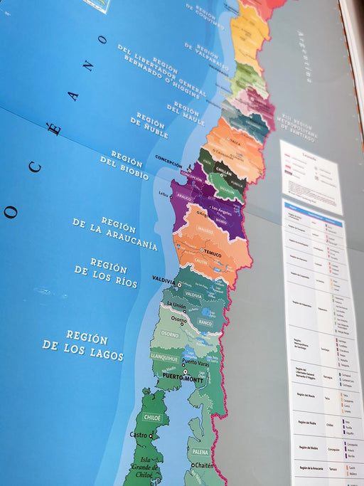
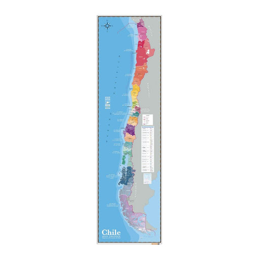
Political Map of Chile updated 2023 - Sheet
Map of Chile, scale 1:2,500,000 with the complete political and administrative division, regions, capitals of regions, provinces and their capital...
View full detailsOriginal price $0 - Original price $0Original price $0$21.900$21.900 - $21.900Current price $21.900 -

 Original price $0 - Original price $0Original price $0$21.900$21.900 - $21.900Current price $21.900
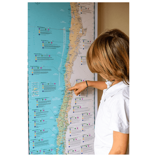
Physical Map of Chile updated 2023 - Sheet
Map of Chile, scale 1:2,500,000 with the political division of the regions, capitals of regions the main cities. It comes with all the physical ele...
View full detailsOriginal price $0 - Original price $0Original price $0$21.900$21.900 - $21.900Current price $21.900 -
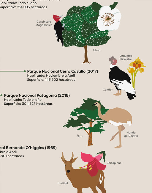
 Original price $69.900 - Original price $69.900Original price$69.900$69.900 - $69.900Current price $69.900
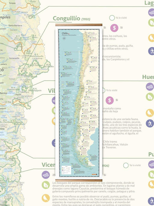
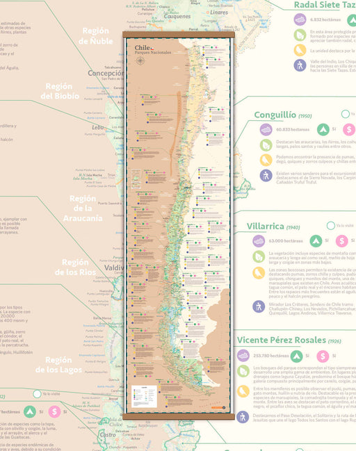
Map of National Parks of Chile - Sheet with Strips
A spectacular tourist map of all the National Parks of Chile to date. Contains the main cities, regional division, information on flora, fauna, exi...
View full detailsOriginal price $69.900 - Original price $69.900Original price$69.900$69.900 - $69.900Current price $69.900 -
 Original price $7.900 - Original price $7.900Original price$7.900$7.900 - $7.900Current price $7.900
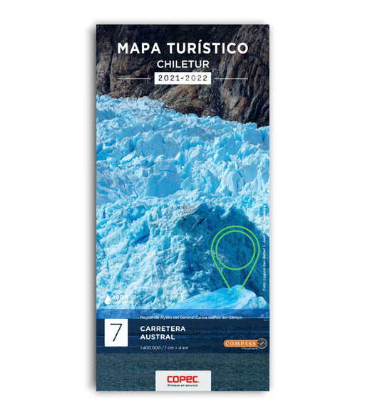
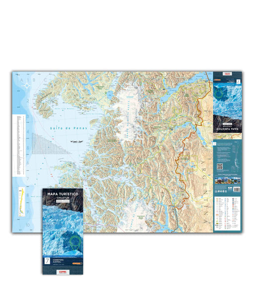
Carretera Austral (2nd Part) - Chiletur Tourist Map
To travel has been said! 2 maps printed on both sides covering 530 kilometers from north to south, from La Junta to Villa O'Higgins, end of the ...
View full detailsOriginal price $7.900 - Original price $7.900Original price$7.900$7.900 - $7.900Current price $7.900 -
 Original price $7.900 - Original price $7.900Original price$7.900$7.900 - $7.900Current price $7.900
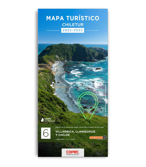
Villarrica, Llanquihue and Chiloé (Carretera Austral Part 1) - Chiletur Tourist Map
To travel has been said! 2 maps printed on both sides covering 530 kilometers from north to south, from Lake Villarrica to La Junta on the Carre...
View full detailsOriginal price $7.900 - Original price $7.900Original price$7.900$7.900 - $7.900Current price $7.900 -
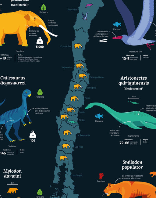
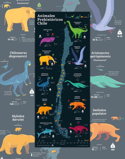 Original price $0 - Original price $0Original price $0$39.900$39.900 - $39.900Current price $39.900
Map of Prehistoric Animals of Chile - Print
Size : 37x91cm Printing : Coldpress Art Paper 310gsm, semi-textured. Author : Yachay Data Shipping : Worldwide rolled in a Mappin...
View full detailsOriginal price $0 - Original price $0Original price $0$39.900$39.900 - $39.900Current price $39.900 -
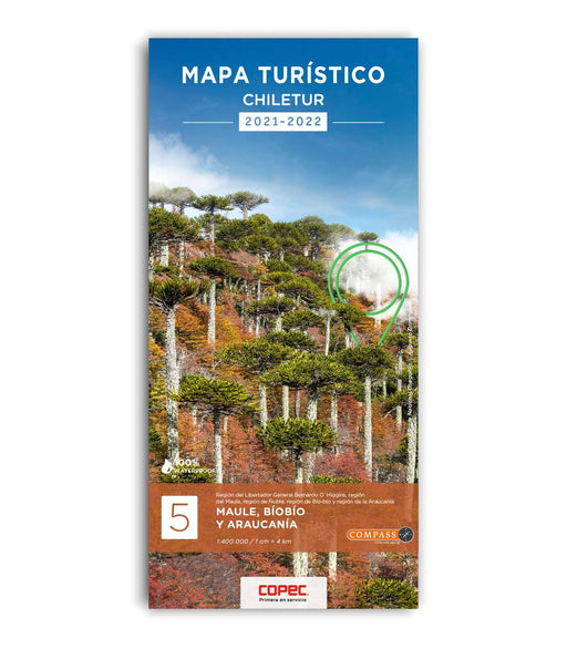
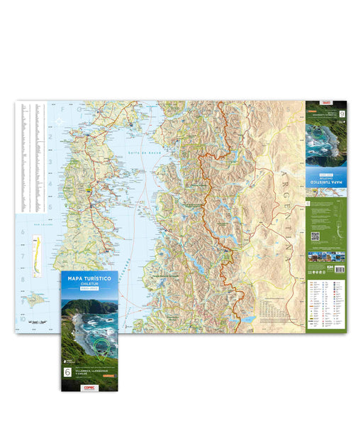
 Original price $7.900 - Original price $7.900Original price$7.900$7.900 - $7.900Current price $7.900
Maule, Biobío and Araucanía - Chiletur Tourist Map
To travel has been said! 2 maps printed on both sides covering 530 kilometers from north to south, from Rengo/Pichilemu to Lake Caburgua. Highli...
View full detailsOriginal price $7.900 - Original price $7.900Original price$7.900$7.900 - $7.900Current price $7.900 -
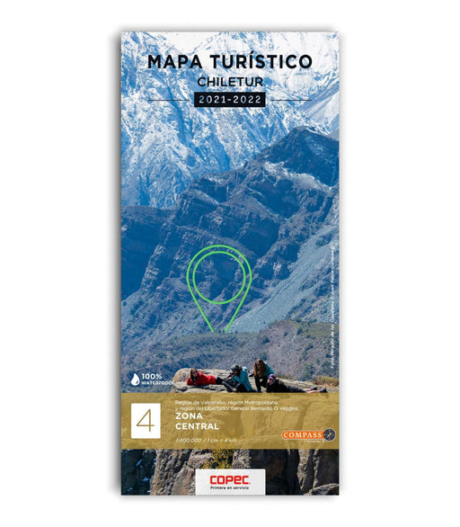
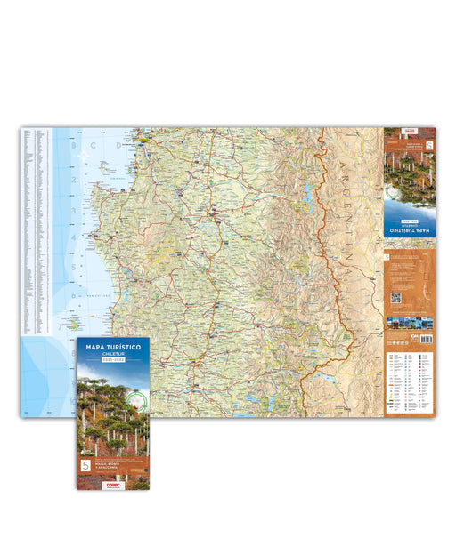
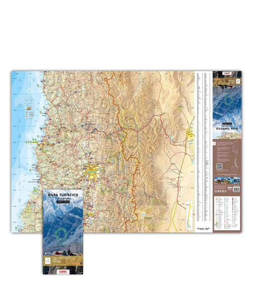 Original price $7.900 - Original price $7.900Original price$7.900$7.900 - $7.900Current price $7.900
Central Zone - Chiletur Tourist Map
To travel has been said! Map printed on one side covering 280 kilometers from North to South, from Los Vilos to Rancagua; on the other hand, 3 u...
View full detailsOriginal price $7.900 - Original price $7.900Original price$7.900$7.900 - $7.900Current price $7.900 -
 Original price $0 - Original price $0Original price $0$69.900$69.900 - $69.900Current price $69.900
Map of National Parks of Chile Sepia- Sheet with Strips
A spectacular tourist map of all the National Parks of Chile to date. Contains the main cities, regional division, information on flora, fauna, ex...
View full detailsOriginal price $0 - Original price $0Original price $0$69.900$69.900 - $69.900Current price $69.900 -
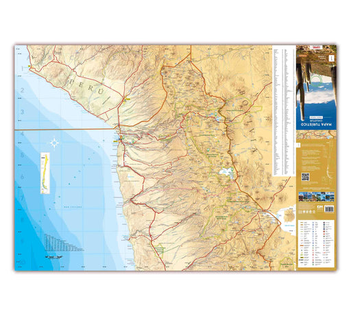
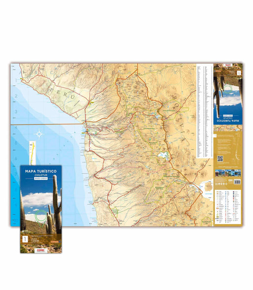
 Original price $7.900 - Original price $7.900Original price$7.900$7.900 - $7.900Current price $7.900
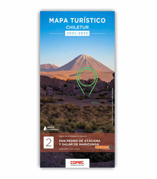
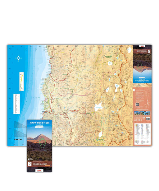
San Pedro de Atacama and Salar de Maricunga - Chiletur Tourist Map
To travel has been said! 2 maps printed on both sides covering 530 kilometers from North to South, from Calama to Caldera. Highlights: Los Flame...
View full detailsOriginal price $7.900 - Original price $7.900Original price$7.900$7.900 - $7.900Current price $7.900 -
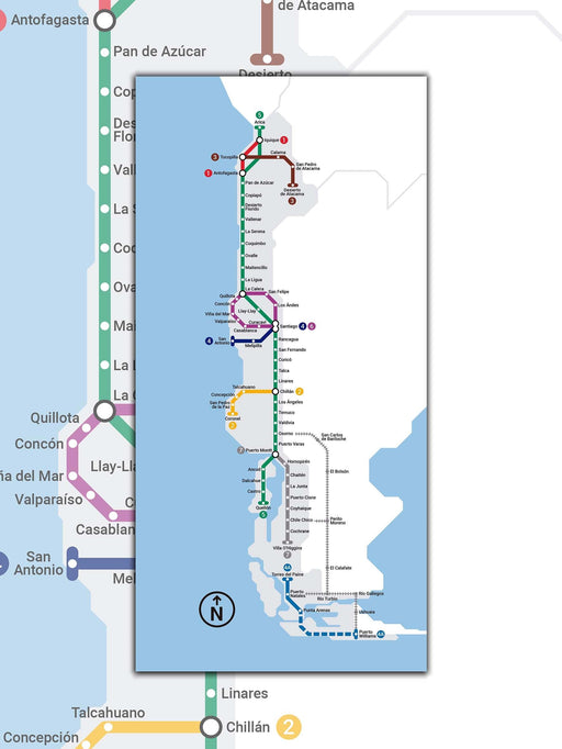 Original price $0 - Original price $0Original price $0$37.000$37.000 - $37.000Current price $37.000
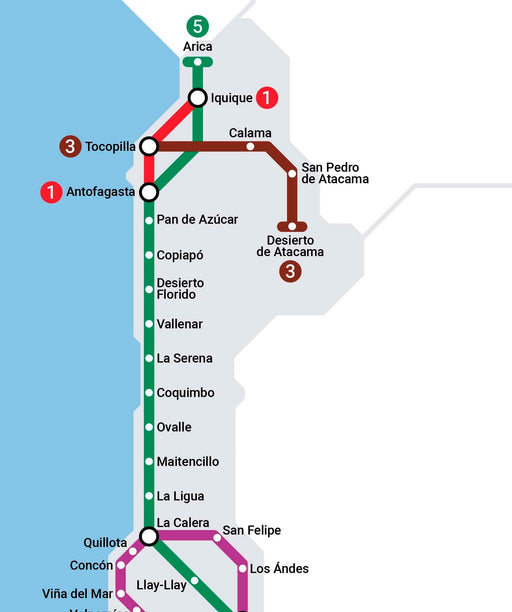
Chile Metro Map - Art Print
Size : 37x75cm Printing : Coldpress Art Paper 310gsm, semi-textured. Author : Carlos Silva Shipments : Worldwide. Reference ph...
View full detailsOriginal price $0 - Original price $0Original price $0$37.000$37.000 - $37.000Current price $37.000 -
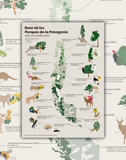 Original price $0 - Original price $0Original price $0$34.900$34.900 - $34.900Current price $34.900
Mapa Ruta de los Parques - Lámina
Tamaño: 50x70cm Impresión: Papel de Arte 230 gsm. Libre de ácido. Autoría: Ángela Rojas & Teresita Cornejo Envíos: A todo el Mundo enrolla...
View full detailsOriginal price $0 - Original price $0Original price $0$34.900$34.900 - $34.900Current price $34.900 -
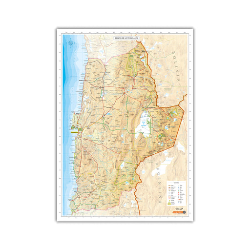 Original price $29.900 - Original price $29.900Original price$29.900$29.900 - $29.900Current price $29.900
Antofagasta Region Map
Map of the entire Antofagasta Region. Measurements: 56 x 79 cm. Scale: 1:800,000 Material: Canson Imaging Paper (Matte) of 180 grs.
Original price $29.900 - Original price $29.900Original price$29.900$29.900 - $29.900Current price $29.900 -

 Original price $7.900 - Original price $7.900Original price$7.900$7.900 - $7.900Current price $7.900
Copiapó and Elqui - Chiletur Tourist Map
To travel has been said! 2 maps printed on both sides covering 530 kilometers from North to South, from Copiapó to Los Vilos. Highlights: Nevado...
View full detailsOriginal price $7.900 - Original price $7.900Original price$7.900$7.900 - $7.900Current price $7.900 -
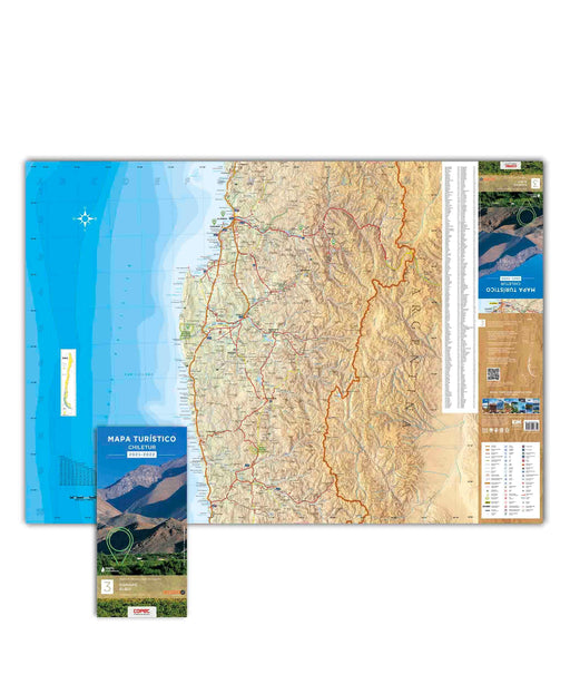
 Original price $7.900 - Original price $7.900Original price$7.900$7.900 - $7.900Current price $7.900
Lauca and Surire - Chiletur Tourist Map
To travel has been said! 2 maps printed on both sides covering 530 kilometers from North to South, from Visviri to Tocopilla. Highlights: Lauca ...
View full detailsOriginal price $7.900 - Original price $7.900Original price$7.900$7.900 - $7.900Current price $7.900 -
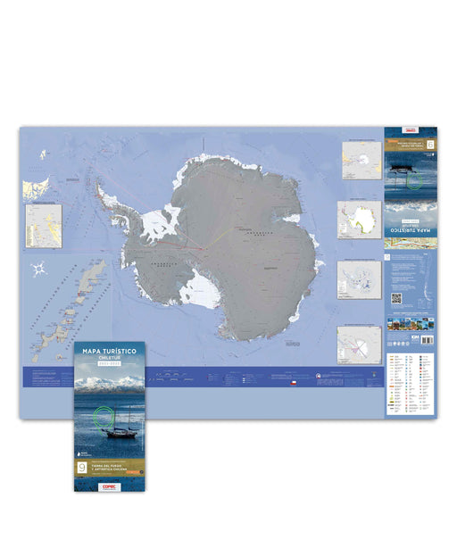
Original price $7.900 - Original price $7.900Original price$7.900$7.900 - $7.900Current price $7.900
Tierra del Fuego & Antarctica - Chiletur Tourist Map
To travel has been said! Map printed on one side covering 270 kilometers from north to south of continental Chile, from Río Grande in Argentina ...
View full detailsOriginal price $7.900 - Original price $7.900Original price$7.900$7.900 - $7.900Current price $7.900Sold out -

 Original price $37.000 - Original price $37.000Original price$37.000$37.000 - $37.000Current price $37.000
Mapa ilustrado del Valle del Maule - Lámina
Tamaño: 86x54cm Autora: Luz María Gutiérrez Impresión: Papel de Arte 230 gsm. Libre de ácido. Envíos: A todo el Mundo enrollado en Caja Mappin...
View full detailsOriginal price $37.000 - Original price $37.000Original price$37.000$37.000 - $37.000Current price $37.000