Skip to content
¿Quieres enmarcar algo? | Envíos a todo el Mundo | Pago en Cuotas

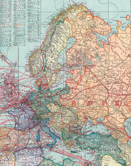
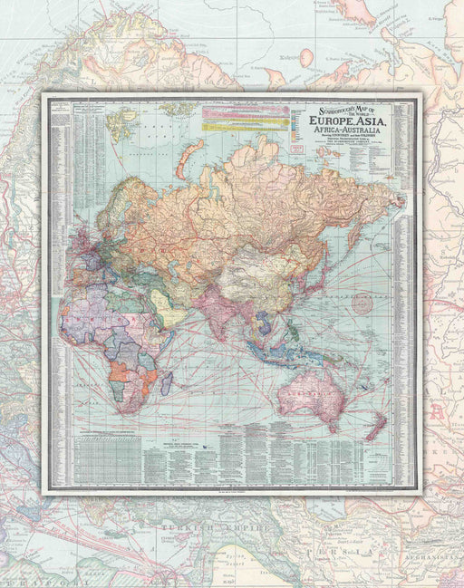
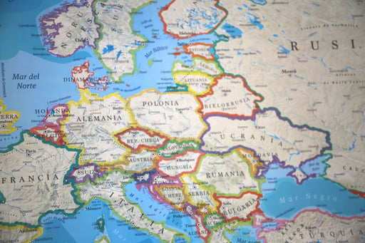
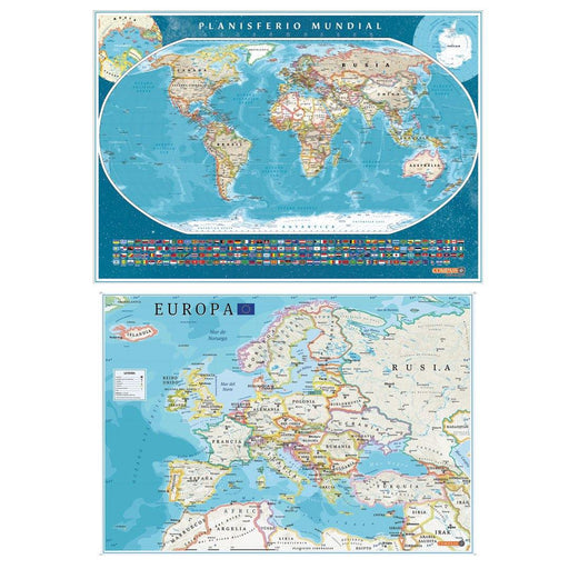
Europe and Asia 1910 - Framed

Save 12% Save 12%
Original price $97,900
Original price $97.900 - Original price $97.900
Original price $97.900
Current price $85,900
$85.900 - $85.900
Current price $85.900
Icon
Fabricamos con cariño

Pide este producto hoy para tenerlo entre el Lunes 17 de Marzo y Lunes 24 de Marzo.

DELIVERY IN 5 TO 8 BUSINESS DAYS.
  • Size: 73x77cm
  • Year : 1910
  • Scale : 1 : 26,000,000
  • Printing: Smooth Art Paper 180gsm.
  • Framed: Directly in natural wood 2x2 cm, includes glass and hangers.

Discover a world of fascinating detail with our 1910 map!

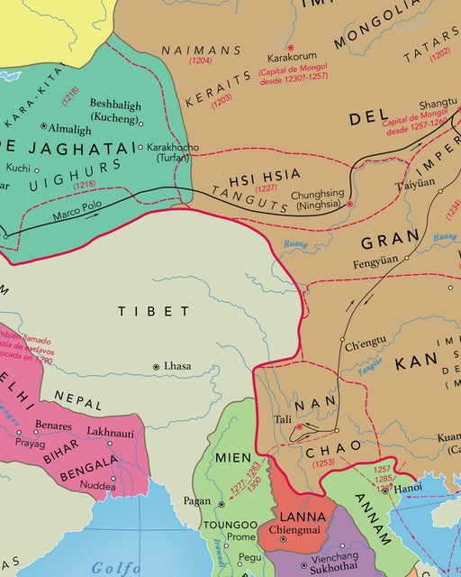
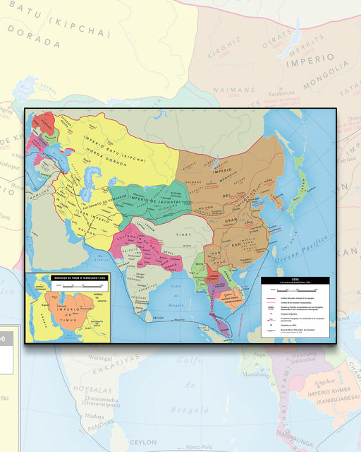
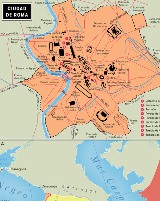
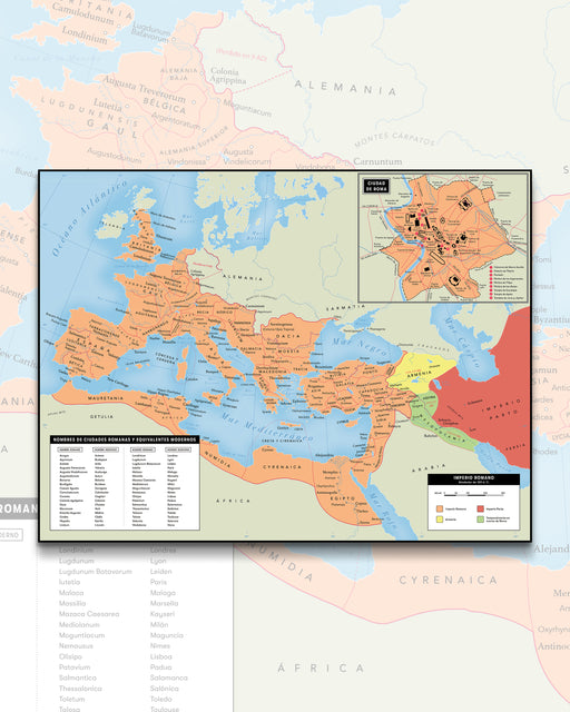
This map of Scarborough Co. (Indiana) shows colonies by color in each territory, railroads built and proposed, steamship and navigation routes, ocean currents, extreme limits of icebergs and ice packs, treaty ports, navigable rivers, canals, main roads, caravan routes, telegraph lines, British consulates, and landforms. And that is only the beginning!

You will also find illustrations of "flags of the world" and portraits of the "chief rulers of the world," directories of "Principal Ocean Steamship Lines," distance tables for steamship routes, special legends for trade, imports, and exports. , Indexed Lists of British and American Consulates, 2 Nautical Mile Scales at Different Latitudes, and Statistical Tables: Armies and Navies of Different Countries, Area, and Population.

It's a comprehensive map that immerses you in the history, politics, and geography of the world!

Pickup available at Tienda Mappin

Usually ready in 2-4 days
Paga hasta en 3 cuotas de $28.633 con débito o crédito y sin interés  

Te podría gustar

  • Original price $39.900
    Original price $39.900 - Original price $39.900
    Original price $39.900
    Current price $31.900
    $31.900 - $31.900
    Current price $31.900

    Europe and Asia in 1910 - Print

    Size: 69x73cm Year : 1910 Printing: Canson 180gsm Art Paper. Shipping : Worldwide rolled in Mappin box. Reference image, Print for...

    View full details
    Original price $39.900
    Original price $39.900 - Original price $39.900
    Original price $39.900
    Current price $31.900
    $31.900 - $31.900
    Current price $31.900
    Save 20% Save %
  • Original price $0 - Original price $39.900
    Original price $0 - Original price $39.900
    Original price $0
    $29.900 - $39.900
    $29.900 - $39.900
    Current price $29.900

    Europe and the Crusades (year 1140), Carolingian Empire (814) - Plate

    Size : 110x84cm This is a detailed and educational printed map showing the geography of Europe at the time of the Crusader states in the y...

    View full details
    Original price $0 - Original price $39.900
    Original price $0 - Original price $39.900
    Original price $0
    $29.900 - $39.900
    $29.900 - $39.900
    Current price $29.900
    Save up to 25% Save %
  • Original price $39.900
    Original price $39.900 - Original price $39.900
    Original price $39.900
    Current price $29.900
    $29.900 - $29.900
    Current price $29.900

    Map of Asia in 1294 - Print

    Size : 91x69cm Includes box of the extension of the Empire of Timur or Tamerlane to 1400. By the year 1294, Asia was undergoing a ...

    View full details
    Original price $39.900
    Original price $39.900 - Original price $39.900
    Original price $39.900
    Current price $29.900
    $29.900 - $29.900
    Current price $29.900
    Save 25% Save %
  • Original price $0 - Original price $39.900
    Original price $0 - Original price $39.900
    Original price $0
    $31.900 - $39.900
    $31.900 - $39.900
    Current price $31.900

    Map of the Roman Empire to AD 120 - Print

    Size : 100x76cm Includes a box with a Map of Rome, highlighting its most relevant points. The Roman Empire Map is a visual representat...

    View full details
    Original price $0 - Original price $39.900
    Original price $0 - Original price $39.900
    Original price $0
    $31.900 - $39.900
    $31.900 - $39.900
    Current price $31.900
    Save up to 20% Save %
  • Original price $0 - Original price $0
    Original price $0
    $25.900
    $25.900 - $25.900
    Current price $25.900

    Political World Map with Flags and Europe 2023 - Art Print

    Planisphere of the world with flags of each of the countries and physical elements, highlighting the capitals of the countries and their main citie...

    View full details
    Original price $0 - Original price $0
    Original price $0
    $25.900
    $25.900 - $25.900
    Current price $25.900