


Antique Barcelona Map - Art Print
Original price
$42.000
-
Original price
$42.000
Original price
$42.000
$42.000
-
$42.000
Current price
$42.000

Envío inmediato
Fabricamos con cariño; pide este producto hoy para tenerlo entre el Martes 28 de Julio y Viernes 31 de Julio.

Fabricamos con cariño
Pide este producto hoy para tenerlo entre el Miércoles 29 de Julio y Martes 04 de Agosto.
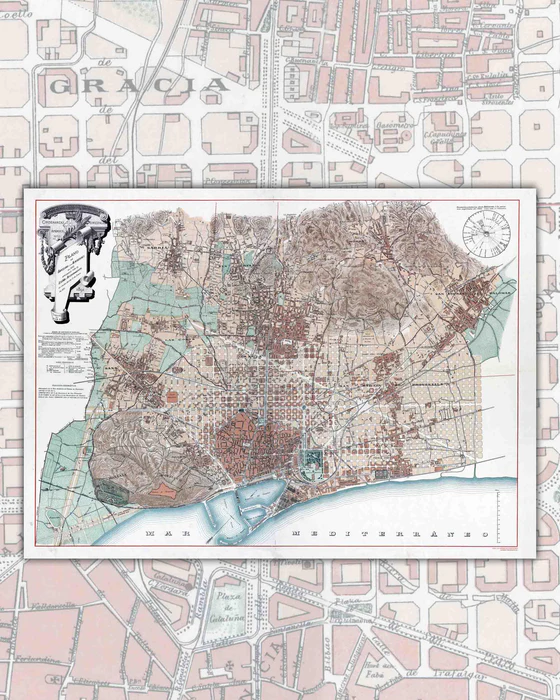
This Map of Barcelona was developed more than 120 years ago, and even so, it is still very valid to this day, due to the preservation of this emblematic city.
It was drawn during the year 1890, the height of the growth of Barcelona and its architectural exponents, such as the famous Antoni Gaudí.
On this map we can see the entire historic center, with its octagonal urban layout, the topography of its hills and the arrival of the city to the Mediterranean Sea through its port and industrial dock.
- Size : 90x65cm
- Printing : 180gsm Canson paper, specialized for art reproduction.
- Reissue and digital restoration by Mappin.
- Year of publication: 1891
- Shipments : Worldwide.