School Maps
-
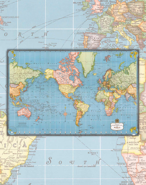
 Original price $0 - Original price $0Original price $0$26.900$26.900 - $26.900Current price $26.900
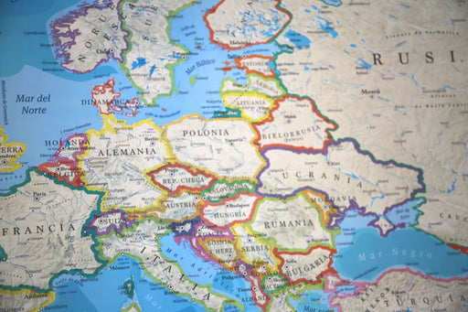
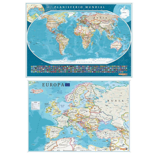
Political World Map with Flags and Europe 2023 - Art Print
Planisphere of the world with flags of each of the countries and physical elements, highlighting the capitals of the countries and their main citie...
View full detailsOriginal price $0 - Original price $0Original price $0$26.900$26.900 - $26.900Current price $26.900 -
 Original price $0 - Original price $0Original price $0$32.000$32.000 - $32.000Current price $32.000
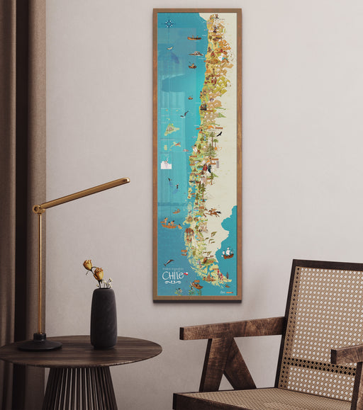
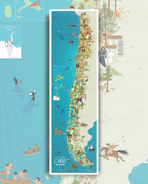
Original Peoples of Chile - Art Print
A second map of Mi Chilito has arrived! This Map offers an educational and decorative tour of the original people of Chile. The illustrator Vero Ba...
View full detailsOriginal price $0 - Original price $0Original price $0$32.000$32.000 - $32.000Current price $32.000 -
 Original price $0 - Original price $0Original price $0$42.000$42.000 - $42.000Current price $42.000
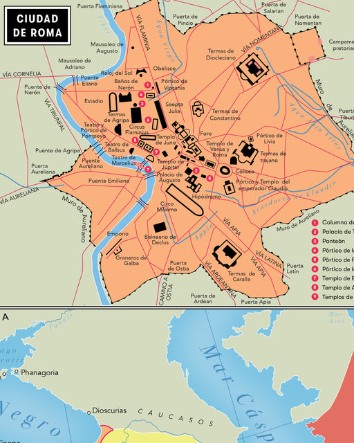
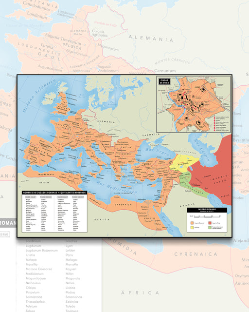
Map of the Roman Empire to AD 120 - Print
Size : 100x76cm Includes a box with a Map of Rome, highlighting its most relevant points. The Roman Empire Map is a visual representat...
View full detailsOriginal price $0 - Original price $0Original price $0$42.000$42.000 - $42.000Current price $42.000 -
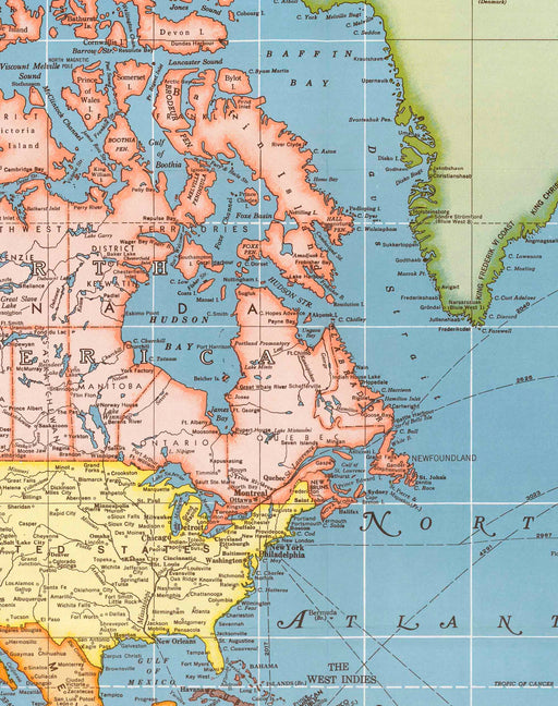
 Original price $0 - Original price $0Original price $0$42.000$42.000 - $42.000Current price $42.000
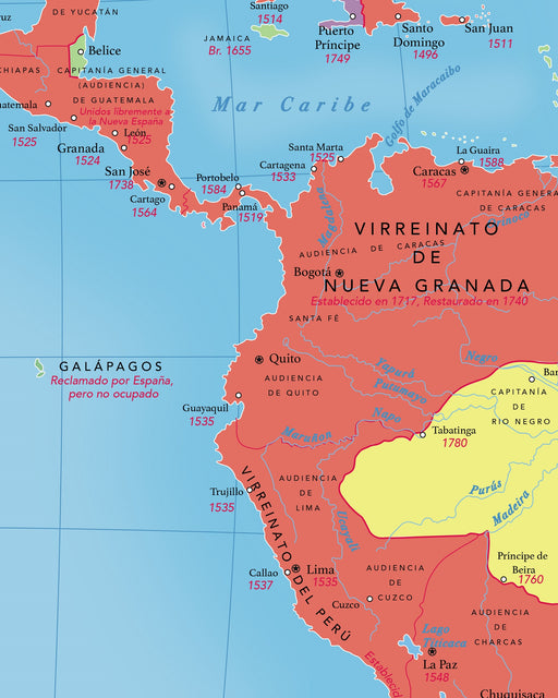
Map of America in 1790 - Art Print
Size : 90x70cm Around the year 1790, the geopolitical formation of Latin America was in full process of evolution. During the colonial er...
View full detailsOriginal price $0 - Original price $0Original price $0$42.000$42.000 - $42.000Current price $42.000 -
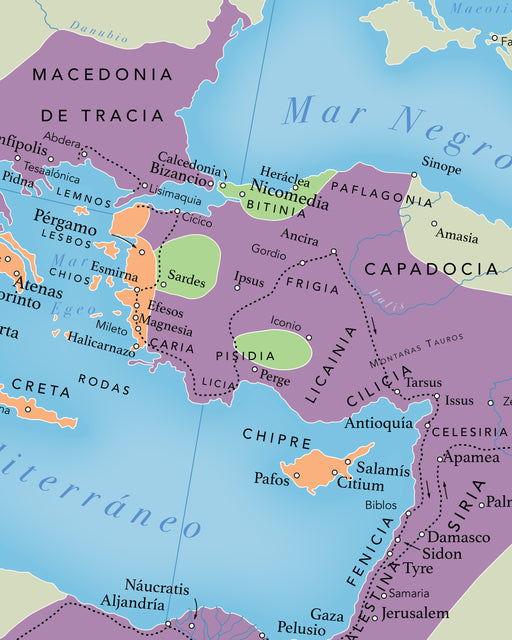
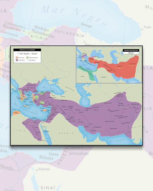 Original price $0 - Original price $0Original price $0$42.000$42.000 - $42.000Current price $42.000
Map of the Empire of Alexander the Great - Art Print
Size : 100x76cm The Empire of Alexander the Great map is a visual representation of one of the largest and most expansive empires in histo...
View full detailsOriginal price $0 - Original price $0Original price $0$42.000$42.000 - $42.000Current price $42.000 -

 Original price $0 - Original price $0Original price $0$42.000$42.000 - $42.000Current price $42.000
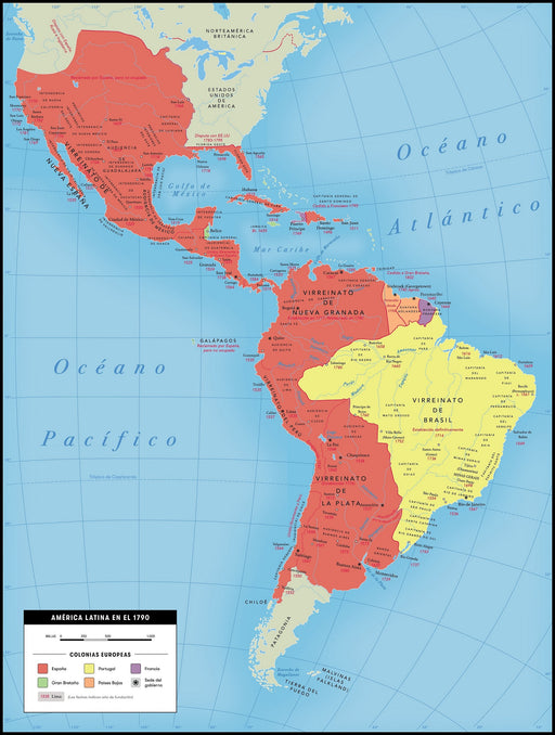
Map of Latin America and Independences - Print
Size : 90x70cm The map of Latin America and the independence of its countries is a visual representation of one of the most significant pe...
View full detailsOriginal price $0 - Original price $0Original price $0$42.000$42.000 - $42.000Current price $42.000 -
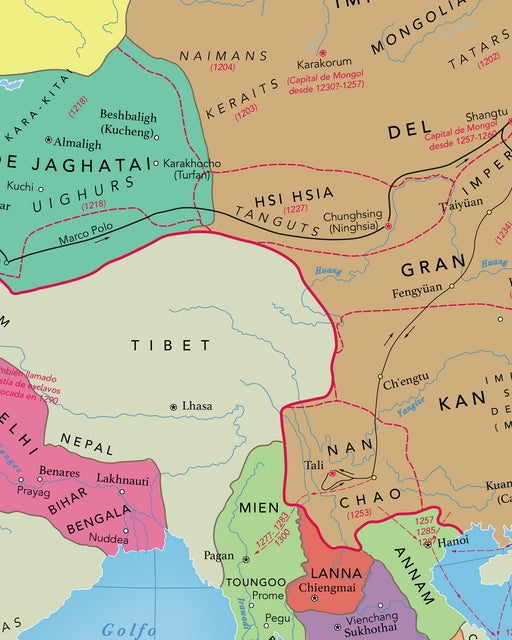
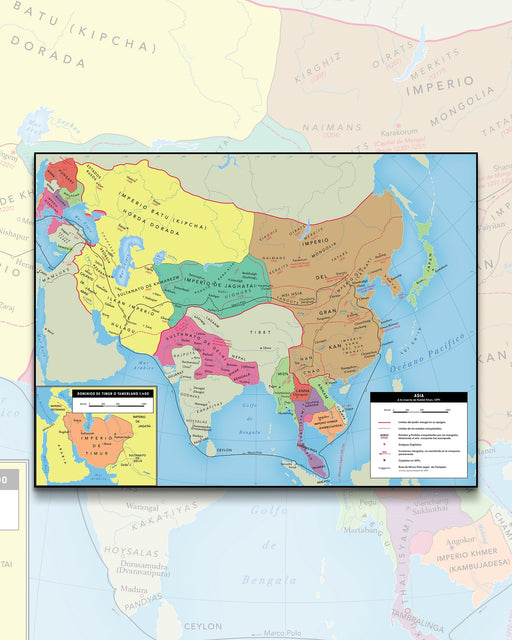 Original price $0 - Original price $0Original price $0$42.000$42.000 - $42.000Current price $42.000
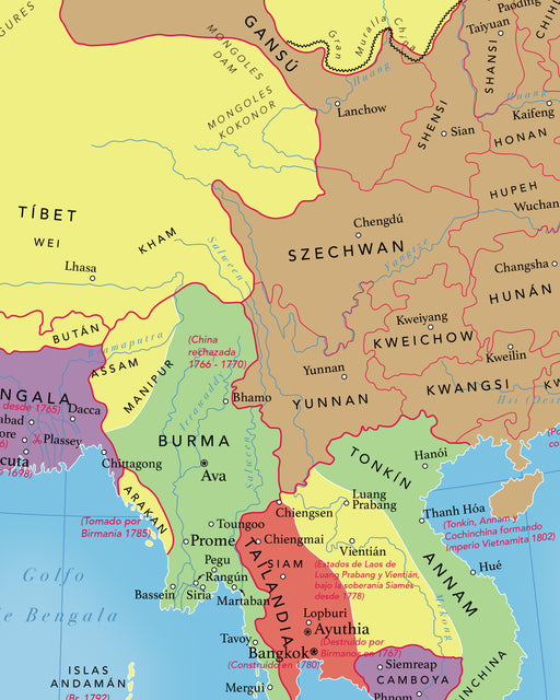
Map of Asia in 1294 - Print
Size : 91x69cm Includes box of the extension of the Empire of Timur or Tamerlane to 1400. By the year 1294, Asia was undergoing a ...
View full detailsOriginal price $0 - Original price $0Original price $0$42.000$42.000 - $42.000Current price $42.000 -
 Original price $0 - Original price $0Original price $0$42.000$42.000 - $42.000Current price $42.000
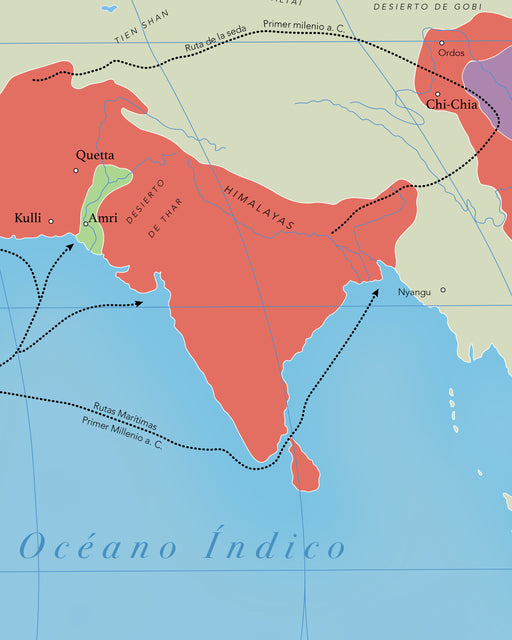
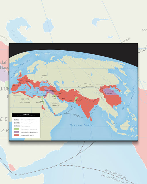
Eurasia The Growth of Civilization - Art Print
Size : 100x76cm This printed map of Eurasia is a fascinating and educational tool that shows the growth and development of civilizations f...
View full detailsOriginal price $0 - Original price $0Original price $0$42.000$42.000 - $42.000Current price $42.000 -
 Original price $0 - Original price $0Original price $0$42.000$42.000 - $42.000Current price $42.000
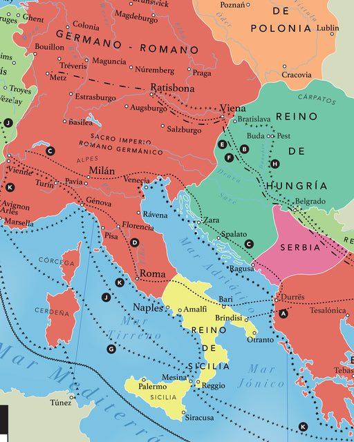
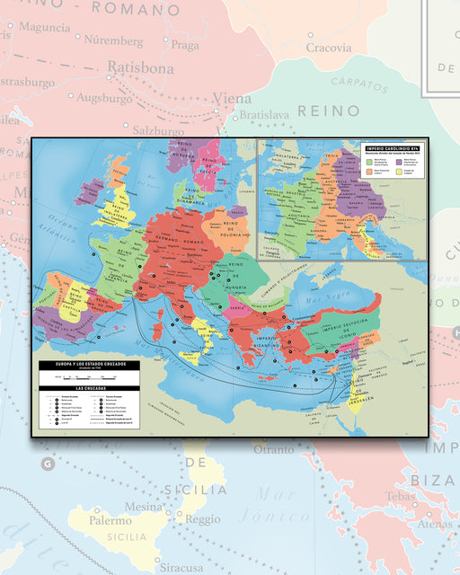
Europe and the Crusades (year 1140), Carolingian Empire (814) - Plate
Size : 110x84cm This is a detailed and educational printed map showing the geography of Europe at the time of the Crusader states in the y...
View full detailsOriginal price $0 - Original price $0Original price $0$42.000$42.000 - $42.000Current price $42.000 -
 Original price $0 - Original price $0Original price $0$43.000$43.000 - $43.000Current price $43.000
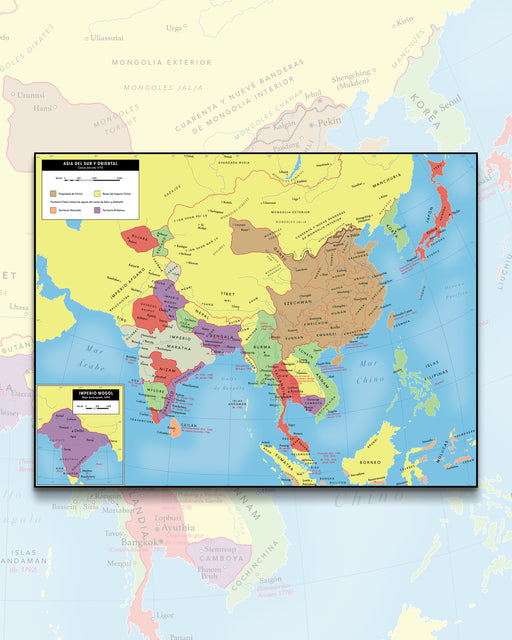
Map of Asia in 1775 - Print
Size : 100x76cm Includes a box with a Map of the Mughal Empire, under the rule of Araungzeb around 1690. The map of East and South Asia...
View full detailsOriginal price $0 - Original price $0Original price $0$43.000$43.000 - $43.000Current price $43.000 -
 Original price $0 - Original price $0Original price $0$39.900$39.900 - $39.900Current price $39.900
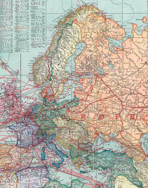
Europe and Asia in 1910 - Print
Size: 69x73cm Year : 1910 Printing: Canson 180gsm Art Paper. Shipping : Worldwide rolled in Mappin box. Reference image, Print for...
View full detailsOriginal price $0 - Original price $0Original price $0$39.900$39.900 - $39.900Current price $39.900 -
 Original price $0 - Original price $0Original price $0$39.900$39.900 - $39.900Current price $39.900
1910 America - Art Print
Size: 69x73cm Year : 1910 Scale : 1 : 26,000,000 Printing: Canson 180gsm Art Paper. Shipments : Within Santiago, other shipment...
View full detailsOriginal price $0 - Original price $0Original price $0$39.900$39.900 - $39.900Current price $39.900 -
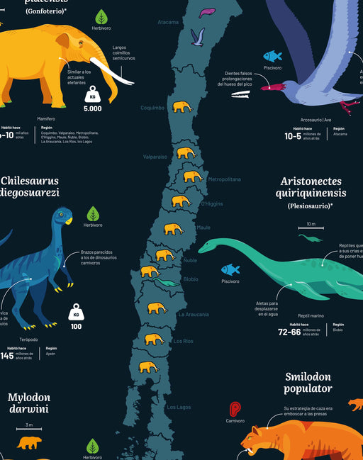
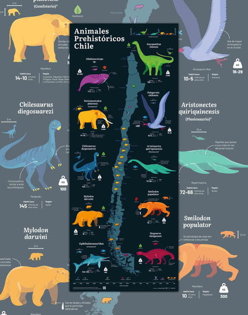 Original price $0 - Original price $0Original price $0$39.900$39.900 - $39.900Current price $39.900
Map of Prehistoric Animals of Chile - Print
Size : 37x91cm Printing : Coldpress Art Paper 310gsm, semi-textured. Author : Yachay Data Shipping : Worldwide rolled in a Mappin...
View full detailsOriginal price $0 - Original price $0Original price $0$39.900$39.900 - $39.900Current price $39.900 -
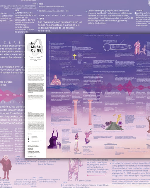
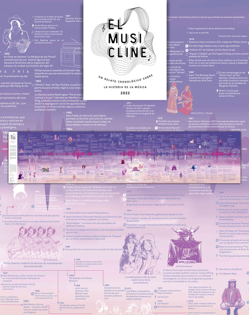 Original price $0 - Original price $0Original price $0$57.000$57.000 - $57.000Current price $57.000
Musicline: Music Timeline - Art Print
Size : 180x40cm Printing : Fine Art Canson Art Paper 180gsm. Author : Valentina Stone Shipments : Worldwide rolled in Mappin Box...
View full detailsOriginal price $0 - Original price $0Original price $0$57.000$57.000 - $57.000Current price $57.000 -
 Original price $0 - Original price $0Original price $0$39.900$39.900 - $39.900Current price $39.900
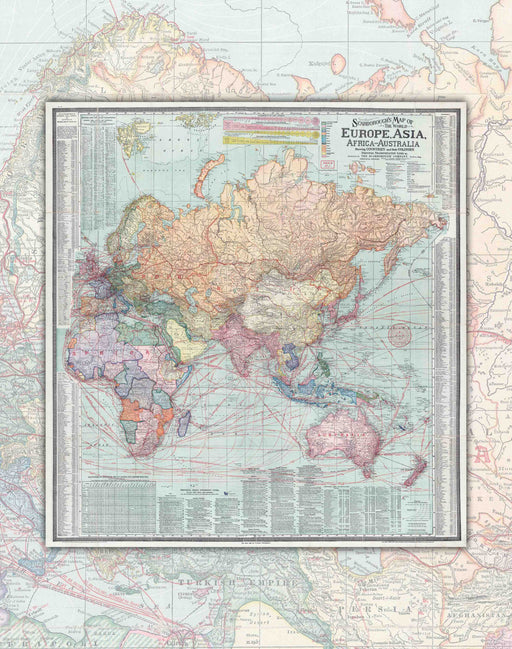
World Map 1957 Hammond - Art Print
Size: 105x69cm Impression: Art Paper 1957 Scale : 1 : 33,880,000 Shipments : Worldwide rolled in Mappin Box. The 1957 World...
View full detailsOriginal price $0 - Original price $0Original price $0$39.900$39.900 - $39.900Current price $39.900 -
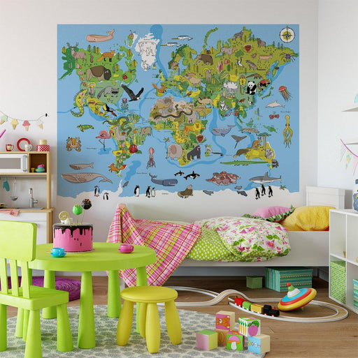 Original price $0 - Original price $0Original price $0$54.900$54.900 - $54.900Current price $54.900
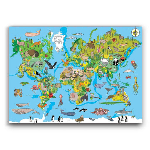
Children's World Map - Mural Paper
IT TAKES 7 BUSINESS DAYS TO BE READY Animals? Places? countries? All this and a thousand colors in an educational World Map that Pajarito de Mim...
View full detailsOriginal price $0 - Original price $0Original price $0$54.900$54.900 - $54.900Current price $54.900 -
 Original price $0 - Original price $0Original price $0$54.900$54.900 - $54.900Current price $54.900
Updated Color World Map - Deco Mural
IT TAKES 7 BUSINESS DAYS TO BE READY! Wow! Now we did make it luxurious. For a long time we wanted to make Deco Murals that were simple to insta...
View full detailsOriginal price $0 - Original price $0Original price $0$54.900$54.900 - $54.900Current price $54.900 -
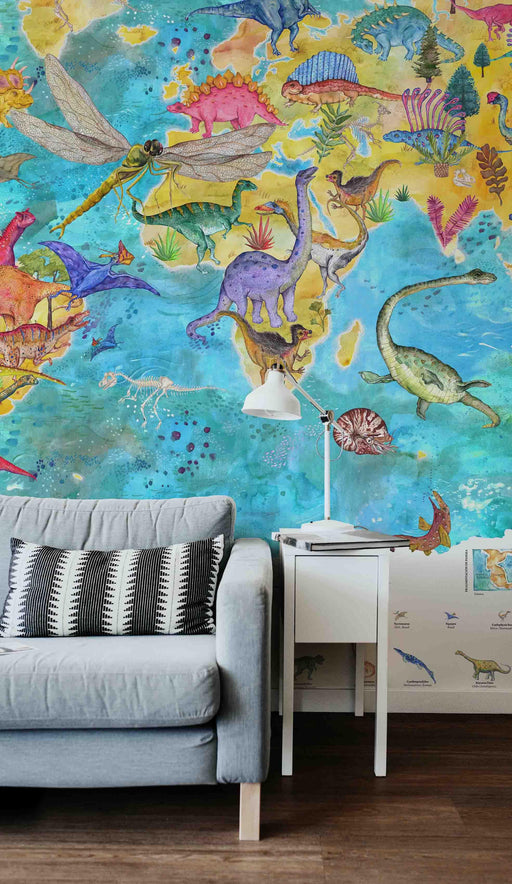
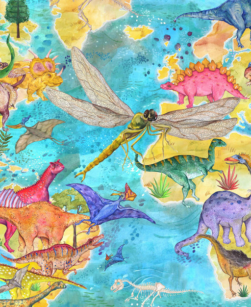
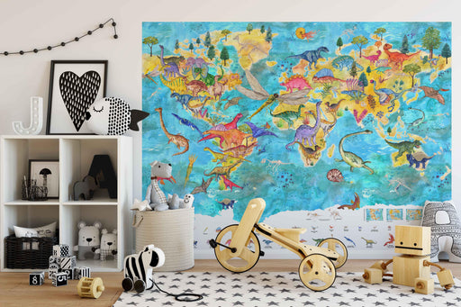 Original price $0 - Original price $0Original price $0$54.900$54.900 - $54.900Current price $54.900
Dinosaur World Map - Deco Mural
IT TAKES 7 BUSINESS DAYS TO BE READY Size : 183x135cm Printing : 100% vinyl textured wallpaper, very easy to install. Author : Francisc...
View full detailsOriginal price $0 - Original price $0Original price $0$54.900$54.900 - $54.900Current price $54.900 -
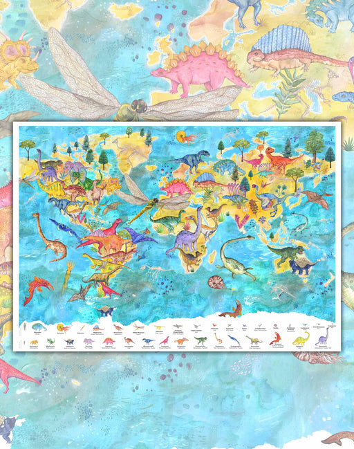 Original price $0 - Original price $0Original price $0$42.000$42.000 - $42.000Current price $42.000
Dinosaur World Map - Art Print
Size : 98x68cm Printing : Canson Art Paper of 180grs, specialized for art reproduction. Author : Francisca Palomas del Río Shipment...
View full detailsOriginal price $0 - Original price $0Original price $0$42.000$42.000 - $42.000Current price $42.000 -
 Original price $0 - Original price $0Original price $0$45.000$45.000 - $45.000Current price $45.000
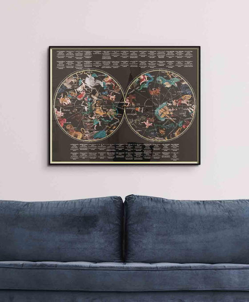
Illustrated Celestial Map - Art Print
Size: 90x70cm Printing: High quality semi-gloss Luster Photo Paper. Author: Alexis Perez Shipping: Worldwide rolled in Mappin Box. Re...
View full detailsOriginal price $0 - Original price $0Original price $0$45.000$45.000 - $45.000Current price $45.000 -
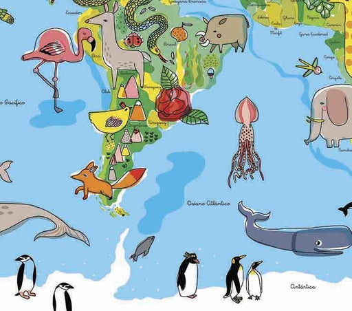
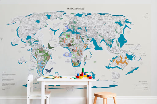
 Original price $0 - Original price $0Original price $0$42.000$42.000 - $42.000Current price $42.000
Children's World Map - Print
Animals? Places? countries? All this and a thousand colors in an educational World Map that Pajarito de Mimbre made especially for boys and girls w...
View full detailsOriginal price $0 - Original price $0Original price $0$42.000$42.000 - $42.000Current price $42.000 -
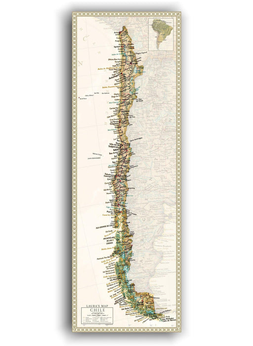 Original price $0 - Original price $0Original price $0$39.900$39.900 - $39.900Current price $39.900
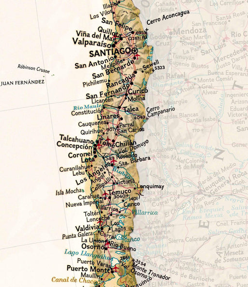
Map of Chile 2023 Sepia - Print
"It all started when we wanted to hang a map of Chile in our house, but we couldn't find what we were looking for. We wanted an updated map of Chi...
View full detailsOriginal price $0 - Original price $0Original price $0$39.900$39.900 - $39.900Current price $39.900 -
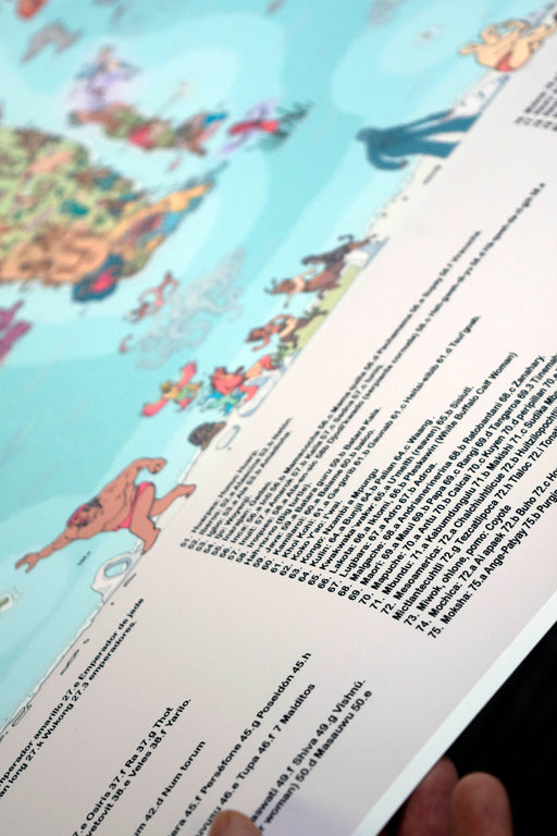
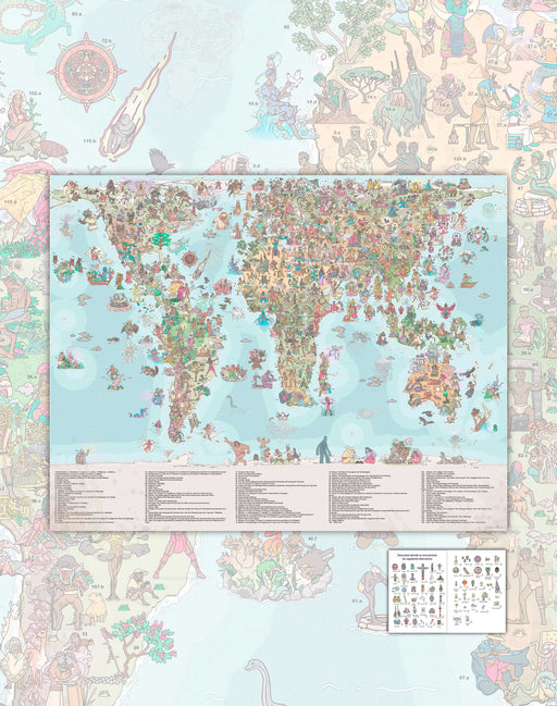 Original price $38.000 - Original price $38.000Original price$38.000$38.000 - $38.000Current price $38.000
Map of the Beliefs of the World - Art Print
PRE-SALE: AVAILABLE FROM JUNE 19 Size: 90x70cm Printing: Canson Art Paper 180gr Author : Thomas Moreno Shipments : Worldwide ro...
View full detailsOriginal price $38.000 - Original price $38.000Original price$38.000$38.000 - $38.000Current price $38.000 -
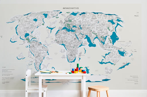 Original price $0 - Original price $0Original price $0$54.900$54.900 - $54.900Current price $54.900
Colorable Animals Mural - Deco Mural
IT TAKES 7 DAYS IN PRODUCTION Size : 135 x 225cm Printing : 100% vinyl textured wallpaper, very easy to install. Includes instructions...
View full detailsOriginal price $0 - Original price $0Original price $0$54.900$54.900 - $54.900Current price $54.900


